I empty my rucksack for the second time, this time in a state of minor panic.
Shorts?
Shirt?
Vest?
Nada. All missing. How has my careful preparation gone so wrong? I message Jen back home. The missing kit is neatly laid over the back of a chair in our living room.
Bugger.
There’s a Decathlon 8 miles away so I ride down there in search of kit. I swipe the last shirt on the display and cross my fingers that it will fit.

Within hours the Atlas Mountain Race 2023 (AMR) peloton is rolling out, silence replaces the nervous pre-start chat and excited police delight in escorting us out of town. Meanwhile locals look on snapping the spectacle on smartphones, it all adds to the race vibe.
The miles build, the sun sets, and we are finally free to push on up a rolling ascent towards a distant range of snow capped mountains.
The darkness is sudden and intense, contributing to the first crash of the race - Jorge overruns a corner smashing his nose and I temper my need for speed.
Kids stand by the dusty red roadside shouting encouragement whilst adults peer out of windows and doors see what all the fuss is about. Flourescent light pours over shop counters and out onto the road. Boxes of crisps, crates of water bottles and stacks of wafer biscuits crowd the tiny shop openings. I stop and buy water, the first of many times on the AMR.


The temperature is dropping and at the top of the first col I stop in the darkness alongside other riders to add layers of clothing for a loose and winding road descent to a village where local police are out marking the route with flashing blue lights.
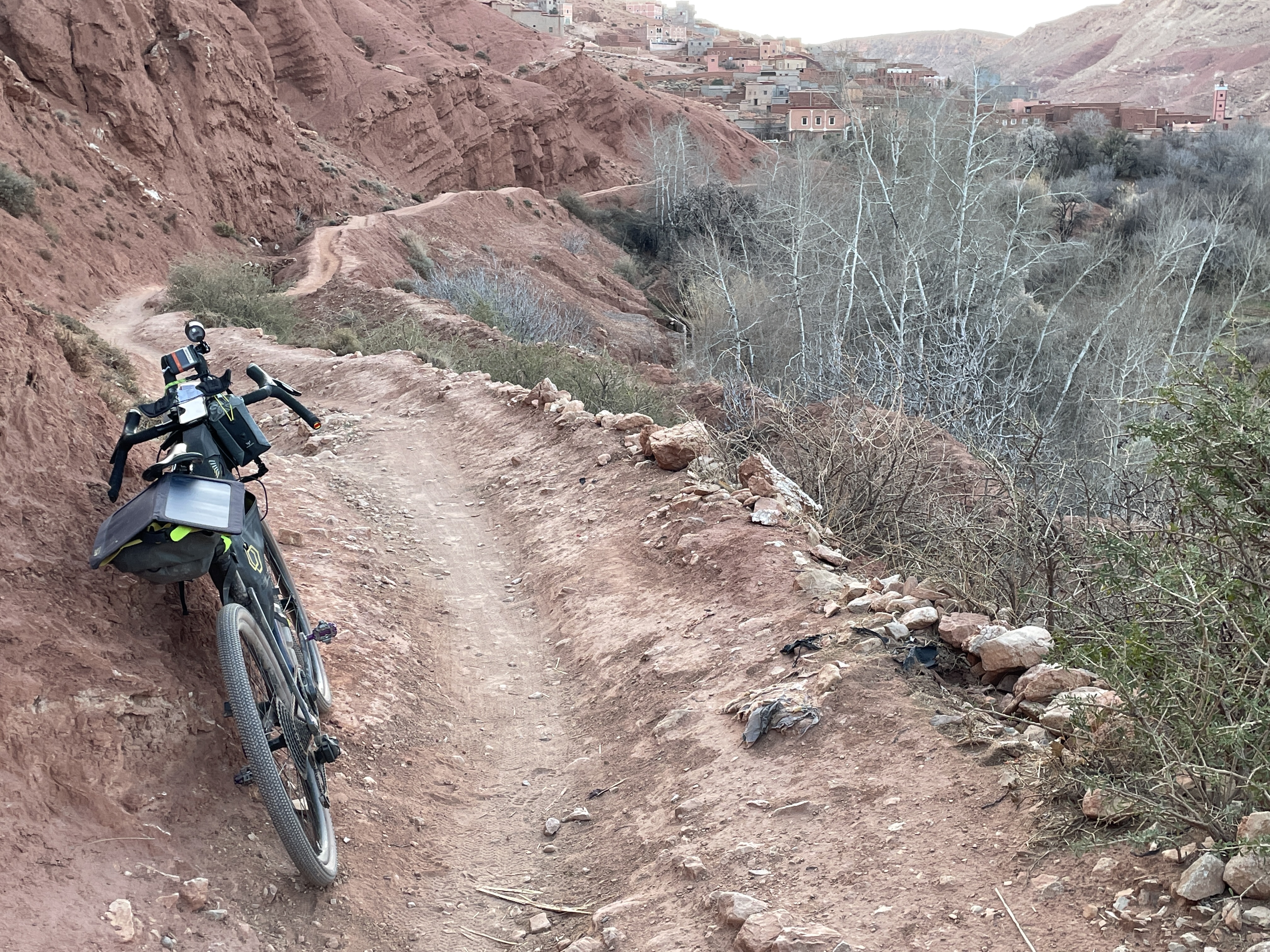
We then point stems skyward and the road surface changes to gravel, a white snake slinking round the knolls and bowls of the ridge ahead of me. I pass through a sleeping village, whitewashed walls reflecting the full moon. High above is a distant snowy ridge which I assume we will climb despite the lack of obvious path. Hairpins become steeper whilst crisp snow encroaches on the trail forcing all but the most determined to dismount and shove. Looking over my shoulder I see an army on the march, a string of battery and flickering dynamo lights moving relentlessly upwards. Tramp, tramp through the snow, freehubs ticking a guilty reminder to the hikeabikers. More layers; a down jacket, windproof jacket, merino buff, mitts and I’m now wearing every item of clothing that I brought. Will it get any colder?
Distant red tail lights finally reveal the route over the ridge high above us, it will be at least an hour before I reach the col.
The descent is actually harder, the notorious hikeabike is not obvious on the ground and I’m soon hauling my laden bike over glistening limestone and quarz boulders in the search for a path. Once I do stumble onto the path it’s on the edge of rideable. Its been at least 7 hours since we left the easy miles of Marrakech for the mountains and my brain is is slow avoiding the snow drifts which lie in every hollow. Minor offs are all part of the mission to escape the mountain and reach the first checkpoint (CP1) at Telouet. CP1 is obvious from the pile of expensive bikes abandoned in the road for the promise of hot food and drink within. Inside, riders huddle around a roaring wood burner in the far corner of a rustic hall, tagines and tea are served and hushed conversation is punctuated by the occasional loud snore of a napping survivor.
I remind myself that I’ve completed the toughest 100 km of the race before rolling out under pre-dawn skies. The rest of the day is a blur of double-track chasing distant horizons. Distant snowy peaks to my right, the russet tones of sandstone to my left. This landscape offers an illusion of tranquility; only the whisper of wind for my ears, blue sky and sand for my eyes.


I detour for lunch, my second omelette of the day served with the traditional round bread and sweet tea. Post lunch progress is improved, at least until I reach the approach to Imassine which follows a shingle filled river bed. Kids in villages run or ride alongside, some demand 'Bic!' or 'chocolate!' but most offer smiles and outstretched palms for low fives. I meet a frame builder from Lyon test riding his latest Roubam steel XC frame. We discuss the merits of various steel grades on the descent into Immasine before locating more tea, bread and tagine at a dusty roadside shack.
The main road leaving Immasine is edgy, I must have missed the 'no bikes allowed' memo because every car and bus passes within a whisker of my left hand shifter, it's a relief to leave the road for more twisting double-track rolling south toward the Anti-Atlas. Unfortunately the first river crossing of the route soon comes into view, it’s bad timing; wet feet and shoes are a poor start to a night bivvying in the hills. By the time I stop to bed down on a patch of sand my feet are cold and I snatch a few hours poor sleep between the whir of passing riders and the discomfort of numb feet.
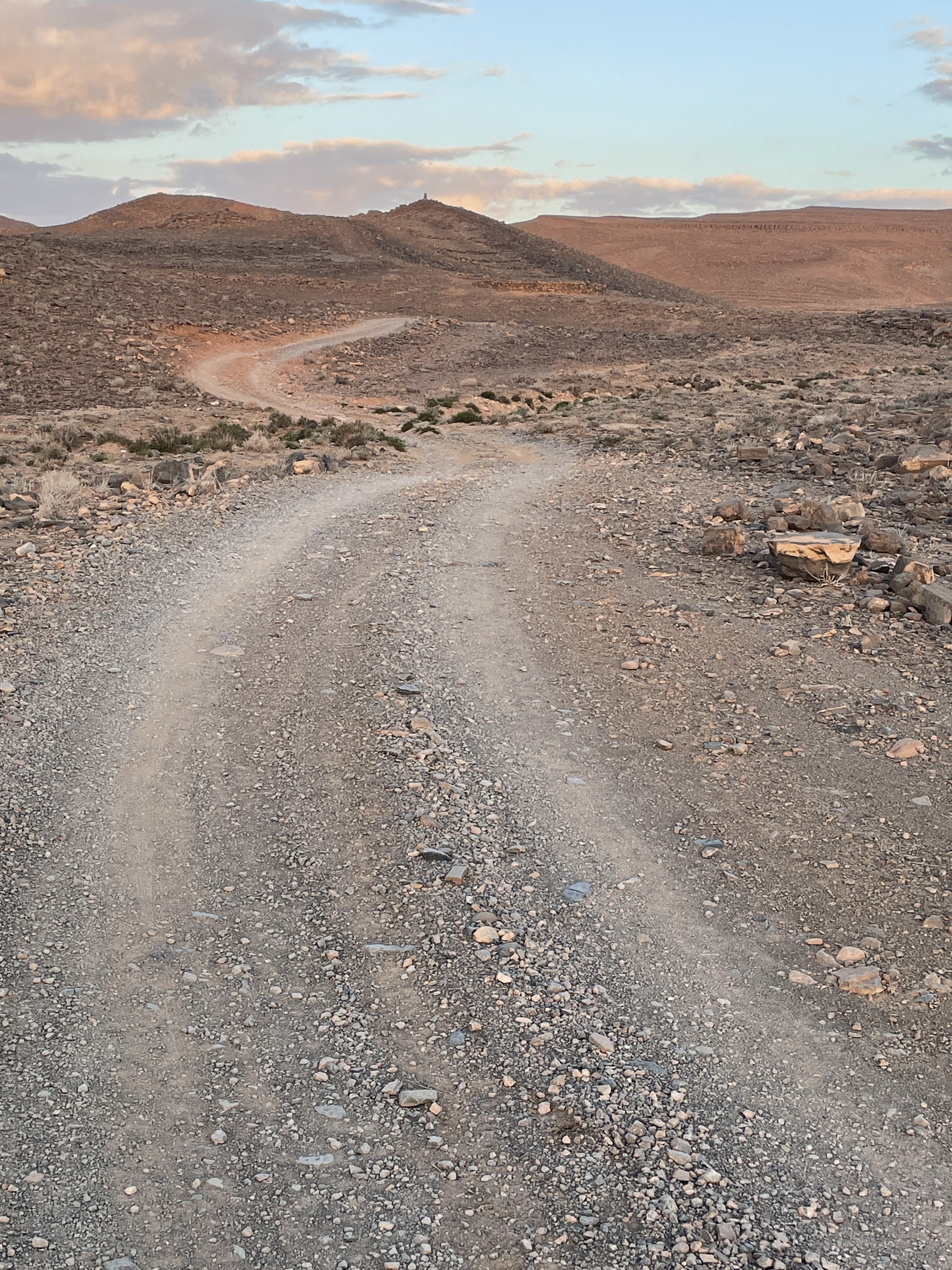
I’m up at 3.30am, moving under moonlight skies, chasing distant red lights in a game of cat and mouse where we are all both cat and mouse. I find it difficult to get enthusiastic about racing on 2 hours sleep at -7 degrees C and I stop more frequently than I should to adjust kit, eat and take photos. Eventually the skies brighten and I grind and shove my way up a series of rocky switchbacks to the spectacular plateau of the Anti-Atlas. Distant rocky escarpments loom over black earth slopes, it’s like Monument Valley up here; angular ridges and dark canyons as far as the eye can see.


The fun isn’t over until my freehub has screamed its way to the bottom of a seemingly endless fast gravel descent. The valley bottom is full of palms and lush green fields irrigated by a network of drainage channels, it’s amazing what life water enables.
I reach the waterfall at Tizgui around 4, Omar is on hand selling tea so I stop to enjoy a glass before tackling the road climb out of the valley. I’m more than a little surprised when he charges me 60 dirham for a glass of tea (the going rate is just a few dirham). He hands me the visitor book which is full of kind comments. I add my own note of polite appreciation in a particularly English gesture.
I buy dates in a layby on the next road climb and leave the tarmac once more as the moon rises. It’s spectacularly bright, reflecting off the limestone rocks alongside the trail and creating all manner of shapes in the shadows. I see sheep, trees, buildings and bizarre creatures in the stones and tumble weed that rush past in my peripheral vision. I stop to take in the absolute silence and spread nutella on a flat bread to see if fixing my blood sugar level reduces the hallucinations. The fatigue persists once I’m rolling though and I’m alone with the sound of my breath on the crisp night air, eyes darting side to side, attempting to rationalise fields stacked with stones which by moonlight resemble mausoleums.
Following another sub-zero bivvy I leave early the next morning to search for breakfast in Taznakt. The town is coming to life as I arrive at 8am, street sweepers are out, shop keepers are putting their shutters up and cafes are putting tables out on wide pavements in the centre of town. I’m on a mission looking for watch batteries for my rear light but all I find are confused looks and shaking heads as I show shop keepers the example battery from my pocket. I do at least find coffee, omelette and bread which are my fuel for the next 70km of nearly dead straight road. I make a stupid mistake on the approach to CP2 taking the wrong route spur and descending several hundred feet towards the palmerie before realising my error. I check the rider manual and retrace my track to then take the correct spur to a bustling CP2 for a stamp on my brevet card.


Night draws in as I freewheel down the canyon from CP2 and I am soon climbing a white gravel track winding towards a distant moonlit horizon. I miss the spectacular canyon views in the darkness of the descent but I sense some big drops to my left; just enough jeapardy to prevent drowsiness.
The following day holds promise; the Colonial Road is a highlight of the race route but first I need to resupply in the town of Tagmout. A dusty red tiled square in the centre of town is lined with stalls and shacks selling everything from a live chicken to a 6 speed bicycle chain. Locals sit around plastic tables sharing silver teapots of sweet tea indulging in the Moroccan pastime of people watching. Out the back of a grocery store I order a bean stew which is a welcome change from the usual omelette or tagine. As I eat it I hear the occasional scream from the live chicken stall, it sounds like some chickens may make it into a tagine today.
I roll out of town on a arrow straight dirt track along the centre of a broad plain flanked by mountains. Soon enough the track starts to wind away to my right up towards the distant heights of a furrowed mountain range. The gradient is easy barring the sections where the bridges are out. Here I throw my laden bike onto my back grabbing stem and seat post to stabilise, tired legs struggle to adjust to the extra 25 kg on my back as I stagger over the rubble of what was a bridge to cross a riverbed and climb back up to the old road.


The road is a fine piece of engineering, beautifully graded it winds to and fro around the hills slowly accumulating altitude. I catch a few other riders on the way up and we descend together as the sun retreats towards the horizon. Magic hour light finds deep shadows in the buckled strata but my eyes are down keeping me on track on my mission for a feed before nightfall. A roadside cafe in the next village feeds me and my fellow riders, I’m also pleased to tap a engineering shop up for some oil to go on my dry and squeaky chain. I leave the village loaded with supplies for the night shift which is spent climbing a gorge to a gold mine.
It’s minus 6 degrees at the top of the gorge, an eerie plateau traversed by massive trucks throwing plumes of red dust up into the night sky. Riders are fleas by comparison, tiny red lights creeping towards the horizon chased down by spotlit juggernauts. I’m tired but sleeping up here is a bad idea. Starting the day cold with a long descent is asking for trouble.
 I bivvy some distance down the descent and am rewarded with a ride through a beautiful palmerie the next morning. I chase the rising sun up the valley onto a winding climb for finally warm hands and feet. Fantastic views propel me smiling all the way to CP3 in the bustling market town of Tafraout.
 The last leg, time to push on up mountain roads past trees heavy with almond blossom, dirt roads snaking between whitewashed houses and cob walled barns before dropping down a thousand feet into a wide rocky valley. I clamber up the far side of the valley at sunset via a set of switchbacks. The next village yields a cafe where I score a random meat daal and strong coffee to keep me focused through the night. As it turns out my batteries need charge so I spend a few hours in a cheap hotel before pushing on towards dawn. I have high hopes for my progress today; singletrack gives way to smooth tarmac and the miles stream by. That is until the sand.


I’ve reached a wide plain, on the far side of which are mountains which the route climbs through. But first, the sand. It starts innocuously enough on a narrow track through a farm opening out to a wider sandy road between two thorny hedges. The sand is deep, and every time I try to ride it my front wheel digs in and stops me in my tracks. I get off and push, and that’s the story for the next 7 miles. The sun climbs, podcasts are listened to and I counter my frustration by reminding myself that the sun is out and I’m not at work.


Eventually clay replaces sand and fields of crops start to line the road. Some fields are full of colourfully dressed workers harvesting crops and one field of mint smells particularly good.


 The final mountains of the route are a welcome contrast after miles of hikabike in the sand. I catch up with a few other riders late afternoon and we find a roadside restaurant serving massive cous cous filled tagines for tea. It’s just what is needed before the switchbacks of the Moroccan Stelvio. It’s late by the time I start the descent off the far side and when I stop to check the map I fall asleep by the trail. I must have fallen into a deep sleep because I’m disorientated when I wake and it takes several miles to get my thoughts together again.
I follow the line on my blue line on my iPhone for several hours and eventually I reach a lake which marks the start of the finishing straight for me. OK, it’s another 50 miles to the finish but it’s rideable in a morning. My enthusiasm is only dented by the loss of an earpod. I ride 4 miles back up the route in my search for it but it’s gone along with two positions in the race results.


I’m lucky enough to pick up a tail wind for the final miles which makes skirting through fields of Argan trees all the more pleasant. The gravel is rough in places but I’m giddy enough to overtake a couple of cars when the going gets rough.
I know the finish is close now, carparks are filled with motorhomes. Poodle owning pensioners vye with hungry surfers for cafe tables and campervan parking.
There’s a small crowd at the finish and it’s good to be in but the truth is that I wasn’t ready for this to end. It’s been a magical week and part of me would like to ride south, exploring previously mythical parts of the map. It’ll have to wait for now, I’ve spied a cold beer and I hear the hammam is worth a visit…


