Showing posts with label cycle touring. Show all posts

Thursday, 15 August 2019

Barcelona or Bust


We emerge from Bordeaux airport at midnight. Cigarette smoke and cheap perfume taint the balmy night as we assemble our bikes under sodium lamps. Nearby, taxi drivers kick banter around to fill the slow, small hours. 
15 year old Arran and I have flown here to start a bike ride which will finish in 6 days time in Port de Pollença, Mallorca - if all goes to plan. First though, we must ride to Barcelona over some of the biggest mountain passes in south western Europe. That is the full extent of our plan, we're carrying bikepacking gear and will sleep and eat where we can.


The stark white light of Monday morning floods the white walls of the breakfast room in our hotel. We come round slowly from a short night's sleep. Suitably stuffed we meander out of Bordeaux along bike lanes which usher us towards the Atlantic coast. Suburbs give way to ancient pine heathland, bracken and heather sweltering under big blue skies. 


The afternoon sees heathland give way to fields of neck high corn. At times it’s a little like a labyrinth, kilometres of narrow lanes flanked by tight rows of head high corn, we blindly follow the arrows on my iPhone keeping an eye skyward for reassurance we are moving south. Skies are darkening by early evening, we hope the threat of rain is empty. That said, water is what we need. Thirst builds with the arrival of dusk, we need water before the morning but every village is dry. We try a few taps at houses shuttered up for the summer break but they are all dry. Ten minutes after sunset on another straight lane between fields I notice a sign outside the back gate of a farm house, “eau potable”. There’s a light on so I knock on the back door and check it’s ok to use the tap in the back garden “bien sur” replies the farmer. 

Lucky.
Fifteen minutes later Arran spots a five star bivvy spot. Short grass, trees for shelter, running water and a toilet. All beside a lake with enough breeze to keep the bugs at bay. Duck calls punctuate the darkness until sleep.

Day 2 

Tat tat tat tat.
Raindrops falling on my bivvy bag, the sky is sullen. We start the day with hike-a-bike up a steep clay track just as the heavens open.  Fat drops of rain which soak us both through and leave us feeling apprehensive - we're in trouble if the rest of the day is this slow and this wet but a forecast of dry skies later in the day keeps me optimistic. Near Lourdes we steal our first glimpse of the mountains through low cloud, YES! Our progress miraculously picks up by 3kph instantly. Security is tight in Lourdes, a tall security fence surrounds the religious centre and guards won’t even allow a bicycle into the area around the shrine. We stop at a cafe in a nearby village which promises a "museo de velo". Sure enough, a shrine to a former world cyclocross and Tour de France champion. It's a fitting start to our climb up the Tourmalet. As we creep past the 1000m contour I can smell and hear the mountains despite the poor visibility. Cold damp air carries the scent of cow dung and mountain herbs. Cowbells ring out from high above and the occasional whir of a free hub heralds another black lycra clad road warrior plummeting from the clouds. Our progress against gravity is less dramatic but no less determined, without a view progress is judged solely by the markers every 1km; “1670m 6km moyen 8.5%” - a warning, a sentence to serve, or the promise of emancipation. It depends on your point of view.
Arran on the Tourmalet old road
Emancipation is cold and wet, we summit soaked by sweat and drizzle anxious to descend from the cloud before we get chilled. A hotel is found on the descent, we're both ready for a good meal and a hot shower.
Arran climbing the upper section of the Tourmalet

Top of the Tourmalet
Tired!

Day 3


The Col d‘Aspin follows breakfast, our first col of the day bagged by 11am - an ascent into lazy cloud lingering at the saddle of peaks that vanish out of sight above us. Speed builds on the descent which winds down the mountain encircling an isolated hillock.
Col d'Aspin


It is reminiscent of Sa Calobra in places, testing the limits of my gravel tyres through the corners until we reach the town of Arreau. Its narrow streets are lined with centuries old houses and whilst it is charming we need to press on up the Col de Peyresource. We’re behind schedule and making up distance in the mountains will be hard work today. Skies have cleared at the col and we duck into a smoky wooden hut where lunch is being cooked.
Groups of cyclists exchange banter whilst waiting for coffee and food. Monteban-de-Luchon is our next stop at the base of the col, the map suggests that food and water may be scarce from here so we stock up before climbing out of France to the Spanish border. Although this is not a major col temperatures of 30 degrees and the ever changing gradient (spiking at 15%) make it feel like hard work.
near Vielha
At the next town (Vielha), the first we encounter in Spain, we once more make a beeline for a supermarket where we bump into bikepacker Andis Boltins. We exchange notes about the next leg of our journey which will take us through the Vielha tunnel. Andis has ridden here from Barcelona - the reverse of our route. He reports that he rode straight through the long tunnel without trouble.
Riding off-road towards the tunnel Pyrenean peaks tower over us, I can't even tell where the tunnel starts. The valley we follow appears to end in a steep slope ahead with no sign of the main road. The 8k long Tunel el Vielha is a major landmark on our journey and we aren’t yet absolutely sure that we’ll be allowed to ride through it. My limited research suggested that we should use the service or old tunnel. At the tunnel entrance I use the emergency phone to check it’s ok to ride on. A misunderstanding results in us using the wrong entrance and minutes later a van speeds up behind us to inform us of our mistake. We return down the deserted old tunnel and enter the new three lane tunnel where a lane has ben closed just for us. Signs inform drivers of “cyclists en tunel". Wow, we get our own lane on the long climb through the tunnel!
The tunnel climbs slowly through the mountain and the sounds are alien, the shrieking hot brakes of lorries in the opposite carriageway, labouring artics crawling past us on their way up to the mouth of the tunnel. Eventually a small white light ahead grows and we exit the tunnel high above a Pyrenean valley. From here we cruise south out of the mountains into a less dramatic landscape, rounded hills replace dislocated limestone peaks, woodland replaces sunburnt mountain pasture. Unsure of what lies ahead we stop 20k later at the first town we encounter, water and an evening meal are required. The town throngs with people enjoying the cooler early evening air, low sun lights the streets and we seek out an open restaurant. It seems that we are early, drinks are ordered ahead of the kitchen opening at our restaurant. It's a good opportunity to catch up on photo editing whilst legs recuperate. The rest does us good, we decide to tackle one more Col before a bivvy, a climb of 650m by moonlight is an unexpected pleasure and we find a bivvy spot near the road at the base of the descent.
last Col of the day
 We’ve ridden 100 miles today and climbed around 12000 ft - we are getting back on track. The skies are beautifully clear, littered with constellations and I don't want to close my eyes. Unsurprisingly we are both fast asleep in minutes, and 6 am comes around rapidly.
Bikepacking - not that glamorous

Day 4

This is crunch day, we are 50km behind schedule if we are to reach Barcelona today and catch our ferry tomorrow. An early start improves optimism but the first town we reach is still closed up at 7.30 am. A strong coffee is ordered and eventually a patisserie opens up so I can buy Arran a large slab of pizza, he's going to need plenty f energy today. It's soon 30°C and water does not last long, quickly transformed to streams of sweat which spatter onto the smooth tarmac.
Arran eyes up another hill
There are a few hills on today’s route but by and large it undulates gently, reminding me of northern Greece. Blinding sun, sweat in my eyes, bleached fields - at least we are heading towards the sea. A three course meal at lunchtime is a good excuse to hide from the heat. Early afternoon is always an ordeal at this latitude, the shops close as temperatures peak and we're left out here grinding our way south. A few more hours and we’ll have won today if I can keep Arran fed though. Unexpectedly we find a shop open at the top of the next climb; half a melon, bread and water seem like a good idea. The melon is shared, its shell scraped clean, and we set off downhill rejuvenated. Urban sprawl replaces fields but it's hours before we get our first glimpse of the Barcelona skyline beyond the suburbs we thread through.
off road into Barcelona
Nearer the city we divert off road onto a series of gravel tracks running parallel to the railway lines and major roads which also head towards the city centre. The early evening sun lights roads deserted by commuters but once we reach the city centre noise and movement dominate. Bike lanes are everywhere and they throng with bikes, electric scooters, even roller skates. We do our best to tag along behind anyone who's moving fast and knows which lights are ok to run. Amidst this chaos it suddenly dawns on us - we’ve made it; 430 miles and 30000 ft of climbing over 4 days.

Pretty impressive at the age of 15.

Day 1

Day 2

Day 3

Day 4


Thursday, 14 September 2017

Torino - Nice Rally 2017


Fiat Pandas1 and Rapha man2: two things that you are nearly guaranteed to find on a Alpine col.

I felt right at home 2000 metres up an alpine col surrounded by men (and women) in full colour coordinated Rapha strip. Sitting on the short grass in groups, gazing out over the valley discussing the merits of various obscure cycle frames, I had found Rapha man's mountain habitat.

In truth, we were all grateful for a break from the seemingly unrelenting loose gravel climb of the Colle Colombardo: 6 miles of climbing at an average gradient of 8.7% interrupted only by an oncoming Fiat Panda with a bale of hay strapped to its roof. This was a tough start to the second Torino-Nice Rally.

The night before most riders had met in the centre of Turin (or Torino in Italian) for pizza, beer and bike spotting. The Piazza Giambattista Bodoni was littered with gravel bikes, cross bikes, classic steel tourers, full sussers, hardtail mountain bikes and all the weirdness that lies in between. We talked route options and swapped tales of similar events until the beer tokens ran out.  A late night tour of Turin's cycle lanes ensued, dodging tramlines and relaxed revellers.

Back at the Piazza for the start of the rally the next morning, the atmosphere was laid back and we didn't leave the square until nearly half an hour after the planned 9am start. Rolling out of the city towards the distant mountains under a clear blue sky, I remembered why I loved riding in Italy. Hectic city streets gave way to fields of golden corn punctuated by traditional villages, each with their church, tricolor flag and troughs of colourful flowers. A section of ancient cobbled roman road was our first encounter with the rough stuff; a good opportunity to see how our fully laden bikes felt off road. My Cannondale Slate felt fine on the flat but the 10kg of luggage I had strapped to it made its presence felt as I started the 1000 plus metre climb to the Col de Colombardo.  I started to doubt whether my standard 52/36 and 11-32 gearing would be suitable. I stopped at a roadside fountain for respite from the midday heat; a welcome chance to refill my backpack with water and cool my head in the chilly mountain water. Little by little, I inched up the loose gravel of the Colombardo to be rewarded by increasingly spectacular views with each gravel switchback. Nearer the col the gradient eased, before I plunged down into the next valley round blind hairpins to the sound of overheated brakes and G-One tyres skating over tarmac .

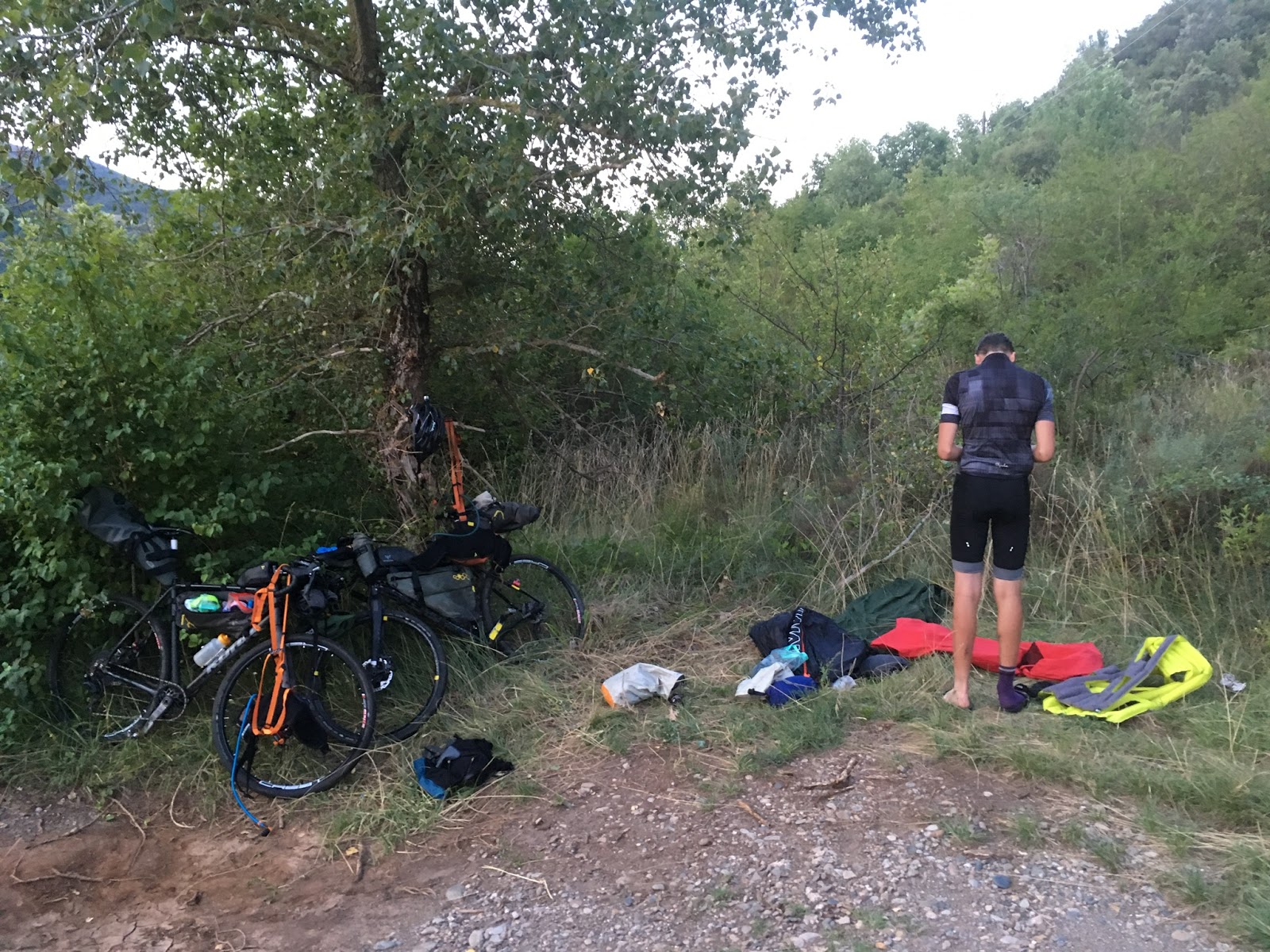
I was riding the rally with Mick, another rider from Yorkshire who I'd run into the night before. He was also excited by the massive descents and like me had no itinerary for the event; eat - sleep - ride should do it. That night we found a good bivvy spot next to a water fountain several hundred metres up the Col de Finestre.
climbing into the night in search of a bivvy spot
What we didn't realise was that French rider Benedicte (one of several woman riding the rally) was trying to take a shower in the fountain as we showed up with our torches blazing. Torches were swiftly turned off in the interests of international harmony.
The next morning we were at the Col de Finestre by 9am for a breakfast of sheep’s yoghurt, cappuccino and fried eggs.
gravel switchbacks on the Col de Finestre climb
Just what we needed before the famous Strada Assietta3 which snaked along the side of the mountain ridge before climbing to the Col de Assietta at 2474m. Motorbikes and 4x4s kicked up clouds of dust as they squeezed past on the Assietta, unsurprisingly we weren't the only ones to seek the cols and abandoned forts along this old road. At one dusty col three Italian old boys on electric bikes inspected my Cannondale Slate and asked questions about the bike, the single-sided fork proving particularly perplexing.

The descent from the Assietta was a riot of scattered stones, vague lines, dust trails and the occasional crack as rocks hit my downtube. Unfortunately it was too much for my front wheel which gave up a spoke to the descent, the rest of the wheel relaxed and bends became more than a tad unpredictable. Mick tweaked the remaining spokes and I restrained my descending to make it to Briançon where a independent bike shop fixed the wheel for an amazing five euros whilst we had coffee.

Progress so far had felt slow, the Strada Bianca4 were more fun than tarmac roads but progress on them in the mountains seemed pedestrian. The smooth tarmac of the 2360m Col d’Izoard was a welcome change, we enjoyed the views switchback by switchback until we made the col just in time to see the sun retiring behind a ridge far above us. The scenery on the far side of the col was more dramatic; razor sharp ridges, limestone pinnacles and scree dominated our view, it was difficult to take in whilst repeatedly gunning for hairpin apexes on the fast, smooth hairpins of the descent. The next morning we climbed the Col Agnel, an idyllic meander up a lush valley to reach the eleven percent ramps of the final kilometres.


climb to the Col Agnel
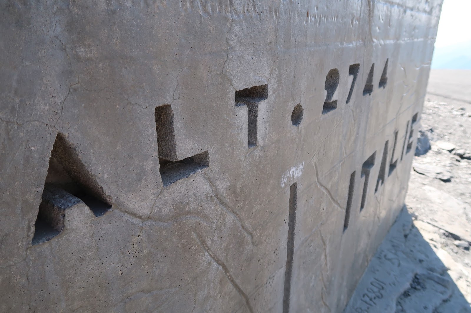
the border stone at the Col Agnel 

The col was already busy with motorbikes and cars so we soon dived down the Italian side overtaking a BMW motorbike on the descent. Near the base of the climb we stopped for a plate of penne pasta and cappuccinos in a traditional village. The elation of the descent was soon dampened by news of a road closure ahead followed by a puncture on my Slate which took forty minutes to sort out. Whilst some rally riders obeyed the road closure for cycles we rode through it  and onto the Colle di Sampeyre climb, granted the road was rough in places but no worse than most of the roads back in Yorkshire.

The narrow road was quiet but dark clouds closed in overhead and we saw our first rain of the rally so we didn’t hang about at the top. The famous Death Road beckoned far below and we were looking forward to riding it. We could soon see why this stretch of tarmac, gravel and landslides had become notorious. A ribbon of narrow tarmac clung precariously to the side of a steep ravine, diving under rocky overhangs and burrowing through rocky outcrops leaving rough stone arches which were generally damp, potholed and pitch black inside.  A rusty steel rail served inadequately as crash barrier, in some places it had been ripped through by unlucky cars leaving the ironwork flailing in the breeze.  We stopped to peer down a hundred metres to the final resting place of the road’s victims on the rocks below.
Just one more climb, one more climb; one more climb to the Rifugio Ristretta where we were promised beds for the night. Unfortunately that one climb was around 1500m, initially along the valley bottom and past a couple of villages to open ground. Once past the villages I gazed up at the spruce trees clinging precariously to the steep mountain sides that surrounded us but I could not see where the road went. We knew though that it must climb up there for us to reach the hidden gem known as 'Little Peru". Following the road round tight hairpins it kicked up and had both of us out of the saddle wrestling handlebars through the hairpins to make the crest of the climb. Meanwhile the clouds closed in again and thunder rumbled in the distance; dusk beckoned. I wondered whether we had stumbled into  a horror film where we would be the unwitting victims.


The tarmac road ended at the Colle del Preit but we kept moving up a gravel track following signposts for the distant rifugio, we did not know how far but we had to be there for 7.30pm or we'd be going hungry tonight. Finally a flag was glimpsed and we rounded a corner to see a collection of old stone buildings with bright red painted doors and window frames, most importantly we’d made it in time to eat.
sunrise in 'Little Peru'

The next morning I was up early to wander over frosty grass under a deep blue sky before breakfast, the feeling of tranquility up here away from roads and villages was sublime. After breakfast we rolled off after through the breathtaking beauty of Little Peru along the old military road. Limestone pinnacles punctuated the skyline and far below cows grazed golden meadows between steep scree laden slopes, it was a dramatic landscape. So dramatic that we were soon retracing our tyre marks after a missed turn. A steep shove up to the highest point of the track at over 2500 metres revealed a panorama of peaks stretching far into the distance.
cows grazing in 'Little Peru'


We would have hung around longer but the descent looked like fun and it didn’t disappoint, the track continued to the tarmac road head where we could have turned off to the Pantani memorial at the Col dei Morti however we were keen to press on so we'd be in Nice the following day. The descent into Demonte seemed endless, we passed shepherds, a cafe and a group of Lada Rivas on the rollercoaster of a road. It twisted and turned through blind gravel strewn bends until we ran out of gradient in Demonte. A quick stop at a bakery for focaccia and pizza fueled us for the next two minor cols but the big one was coming up at the border. The  Col de Tende, although tarmac on the way up would be more of a challenge. There is an unwritten rule though that before leaving Italy via the Col de Tende you must buy gelato and fortunately we found the best gelati in Piemont-Limonte. The lemon sorbet and fruits of the forest ice cream that we indulged in were out of this world, bursting with crisp natural flavour and just what we needed after a thousand metres of climbing in the midday heat.

Col de Tende
The Col de Tende was fortunately well graded, it was the old road over the border until a 4km tunnel was built far below us through the base of the mountain. We spun cranks to the col where the road ended, the French had long since stopped maintaining their side of the pass and it had deteriorated to loose gravel with drainage berms every few hundred metres which made for interesting descending at speed on fully laden bikes.

It was now late afternoon and we had no plan for where we’d stay or how we’d get to Nice the next day. We bumped into French rider Benedicte once again and decided to ride together as far as we could make it that night. Following a pizza at a nearby bar we set off up a remote valley towards the biggest dirt climb of the rally - more than 1500m to the top. The pace was relaxed but intent as dusk fell and we turned left onto a forest road that zigzagged up through the trees above us. The track climbed slowly to a ridge by which time it was pitch black apart from a blood red moon rising in the distance. Spinning our way along the ridge we could see valleys far below filled with mist in the moonlight whilst distant streetlights to the south reminded us that we weren’t far from our destination. Nights like this reminded me why it’s so good to get out and ride at night or in the early morning, it was a different world up here in the darkness high above the civilisation of the valleys. The three of us continued up into the cloud and towards the ruins of the Fort de la Forca. Winter gloves and leg warmers were hastily found and wrestled on to numb limbs at the summit just after midnight. It was too cold to bivvy up here so we descended quickly past the Col de Turini to find milder air at 800m. After a few hours sleep by the side of the road we free-wheeled round the remaining tight bends of the Col Turini and along the base of a spectacular limestone ravine towards Nice.
descending the Col Turini
The last few miles into Nice were something of a shock after days in the mountains; trams, traffic lights and the noise of the city all serving as reminders that we were on our way back to normality. Reflecting on our journey at the Cafe du Cycliste I felt privileged to have ridden to the places we’d been in the company of like-minded individuals. James Olsen was absolutely right in his event briefing, it’s a rally not a race; a dram to be savoured, not a shot to be downed. Find out for yourself next September.

1Fiat Panda- small Italian car which doubles as tractor, shepherds dog and spare bedroom.
2Rapha man - Discerning 30 or 40 something male who prefers a garment hand crafted by artisan seamstresses. Seeks adventure
3Strada Assietta - 34km military road dating from the 1800s connecting Sestriere with Pian dell’Alpe, used in the 2015 Trans-Continental Race. Most of the road is at an altitude of more than 2000m
4Strada Bianca - Gravel roads

Gear

Cannondale Slate Ultegra with Hunt Wheels
Apidura bags (Specialized handlebar roll)
Navigation by Komoot on iPhone
OMM Sleeping bags and waterproofs
MSR Shelter

Thanks to James Olsen for the route, Jen@Velofondista for bike prep and Mick for laughs along the way


Wednesday, 28 June 2017

Pennine Bridleway End to End

"I've ticked off a few big rides this year and I'm still thinking about more so I must enjoy them, right? Otherwise it's just masochism", so goes the internal monologue. I turn down the volume on that and look forward. Only a couple of days after returning from Crossduro Oxford I realised that every weekend until late September was taken up with gigs or family holiday. The weekend coming was also close to the summer Solstice which seemed like a good excuse to ride all night. A quick consider of the possibilities offered up the Yorkshire Dales 300 or the Pennine Bridleway. Both would be a big challenge but the Pennine Bridleway won out as I'd been mulling an attempt at the route for a year or two. 

Wife Jen generously offered to drop me at the Middleton Top start point and meet me at the end in Kirby Stephen. She also prepared my bike replacing the bottom bracket which was totally shot after the Capital Trail. Preparation for this kind of thing was definitely getting easier with practice, getting a reliable GPX file of the route was the main headache. I had no idea how long the 180 mile ride would take, Phil Simcock set a record of around 20 hours and 5 minutes in 2015, others had taken more than 24 hours over it. Only one way to find out...

Setting off from the former railway station at Middleton Top south of Matlock I'm feeling relaxed, the disused railway line is mainly flat and fast, a good fifteen mile warmup into a stiff westerly headwind. Limestone trails are beautiful at this time of year, yellow and blue wild flowers, cow parsley and long grass heavy with seed overhang the bright white stone. Further up the Tissington Trail at Parsley Hay I pass groups of school kids on Duke of Edinburgh expeditions, for many their first foray into the great outdoors without adult supervision. I'm glad to reach the end of this trail though and reach the first of many sections of single track on the PBW. The descent into and out of Chee Dale gets my heart rate right up and I have to make a conscious effort to shift into easier gears, there's another 20 000ft to climb in the next 24 hours.

Leaving the white stone of the White Peak for the Dark Peak feels good, real progress and a change of terrain. Mud, gritstone and moody grey skies, not that I get much chance to look up, I'm too busy staying upright on the challenging rocky sections south of Hayfield. A brief respite on the Sett Valley railway out of Hayfield before a climb up over Lantern Pike. My GPX route runs into trouble south of Glossop, a dispute over funding of the trail means the trail is officially closed with no official diversion. This throws me off route and I end up in someone's back garden high above Glossop. Back on track at Tintwhistle it's only a hop over the moors to familiar territory. Greenfield, Stanage, Buckstones are all dangerously close to home and a ripped rear tyre allows an opportunity for those 'wouldn't you prefer to be at home on the sofa?' thoughts that periodically surface during any challenge. Tyre fixed with a tubeless repair and I'm on my way, nearly one third of the distance under my belt but plenty of challenges ahead. A couple of minor mechanicals have me deploying cable ties and borrowing bottle cage bolts to make my left hand shifter work, at least it can be fixed. 


The setts of the old Rooley Moor road above Rochdale are always a slog, the ancient route to Whalley Abbey from  Rochdale  is wide and straight but decades of Pennine winters have left their mark. Near the summit above the popular trails at Lee Quarry the setts have parallel grooves worn into them where horse drawn carts have worn the stone away. A reminder of tougher times, when survival required routine hard physical labour. 

The steep descent into Stacksteads is over in a flash and a stop at the Coop is my last chance to pick up food today. Bags filled with bean wraps, croissants, chocolate bars and an emergency Coke I climb up towards Cliviger through the 'Gateageddon' section. There's a gate approximately every two hundred metres on which frustrates progress, fortunately the clouds have passed and evening sun lights the way. I even enjoy the climb out of Cliviger up to Hurstwood and Gorple. The new sections of trail between here and Wycoller are fantastic, fast rolling and well graded, there are even berms through some of the corners and a rock garden mid descent. It's early evening and lambs are playful on the lawn-like short grass alongside the trail, pheasants scatter from the trail ahead and I spot a couple of owls and a gull which is presumably far from home. There's a comedy moment above Wycoller when a lamb and a pheasant run directly at each other after being spooked by my bike before simultaneously changing direction at the very last second, the lamb looks very confused. 

I've ridden this middle section though to Settle once before on a recce ride, something I'm glad of as the trail gets very vague south of Long Preston and in the darkness it's difficult to spot the way marker posts. Still summer nights are always thick with insects looking for food, the odd one ends up in an eye, or worse, in my mouth. Dropping down into a steep wooded valley the thick scent of wild garlic hits me as I duck and dive through a tight tunnel of trees. On the far side of the woods Saturday night is in full swing, I pass several pubs with live bands and a large recently built house lit up like a christmas tree for all to see. Through the floor to ceiling windows I can see twenty or so immaculately dressed guests taking their places at a long table, I'd rather be out here I think to myself and press on north. I don't see anyone else until a farm near Long Preston where a farmer comes out to shine a torch in my face and ask what I'm doing. I apologise for scaring them, don't suppose they see many people out here at this time of night. 

By the time I reach Settle it's a new day but Saturday night's party is still in full swing at the Rugby Club where the local Moto Guzzi (motorcycle) Club are having their Summer Camp. I stop round the back of a dilapidated barn for ten minutes above the town to eat bean wraps and enjoy the view. Noisy bunch down there, most of them are customers of ours at work. I don't know the route from here very well, a glance at the map during the week showed it climbing over the south eastern shoulder of Ingleborough not far from Gaping Gill. To get there the route meanders along farm tracks and winding single track between crumbling limestone dry stone walls before climbing onto the flanks of Ingleborough. I push up one particularly loose, steep climb and am aware that I'm tiring, this is the most difficult time of night, my body clock wants to shut everything down for rest and yet I need to keep going. The emergency Coke is pulled from my pack and downed, within ten minutes I'm more alert and I imagine that I can see the silhouette of Ingleborough to the north east, the sky is slowly modulating from black to darkest blue grey.

Climbing up the track to Cam End I feel stronger with the dawn of a new day, the climbs are all ridden with the assistance of a tail wind and the well surfaced track encourages rapid climbing. I was last here twenty years ago in an ageing Land Rover which later caught fire near Settle after some over enthusiastic green laning. Back then the former Roman road was pot holed and rutted, this morning I find it in better condition than many roads in West Yorkshire. To my right I can see a couple of bright LED lights, I assume they are other cyclists on the road climb to Hawes but they are of course lights outside a house, at least I'm not yet hallucinating as I did on my 600k day ride. The descent from Cam End is another highlight of the route, a smooth and well surfaced strip of single track snakes down the hill to the junction with the Dent road. I laugh out loud at several points as I'm launched skyward, maybe that's an effect of sleep deprivation.

Descending the Old Coal Road to Garsdale Head I'm under the impression that the climbing is pretty much done for this ride. I'm proved very wrong, there are at least two more largish climbs and I'm not ready for them. Enthusiasm ebbs as the minutes tick past, I'm conscious that any hope of a sub twenty hour time has gone. I just want to finish now but the real stinger is the final climb, it looks like the trail funding ran out here, the track is way marked over lumpy moorland but there's no surface and no easy grading. The route heads straight up from the valley bottom to the ridge. I push most of it which makes it painfully slow but I no longer have the strength to keep the bike moving in a straight line at granny gear pace. I can't help thinking that whoever planned this section had a wicked sense of humour. At least the descent on the far side is better, finally on the road to Kirby Stephen I've just about cracked it. I roll in to the railway station at 0645, 21 hours and thirty six minutes after I left Middleton Top. I get a lift from here, I've no enthusiasm for a twenty mile road ride for a shower and change of clothes. Sunday is going to be a day of rest. 


Credits

  • Velofondista for last minute bike preparation
  • Jen for support, supplies, lifts and endless patience

Stats

  • 20 300ft climbing
  • 181 miles
  • 9.9mph moving average
  • 21hours 36minutes elapsed time